house of nature, state forestry office bonn
| terrain model | |
| data acquisition | |
| multimedia-software | |
| touching allowed ! | |
The area of responsibility of the Bonn Forestry office also encompasses further parts of the Cologne recess. The model shows the flat flood plain of the southern Lower Rhine, after it has left the Rhenish Schiefergebirge in the south east, and the edges of the bordering highlands of the Bergisch land in the east, as well as the Eifel in the south west.
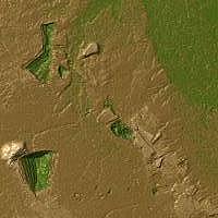
Not far to the west of the Cologne agglomeration, the large lignite open cast mines can be found, which form above all else the loess rich Börde landscape both through large erosion as well as from massive ground filling. All of these morphological phenomena are very visible on the CNC-complex model and replicated to scale.
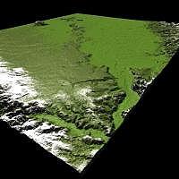
3D oblique view
from south-east
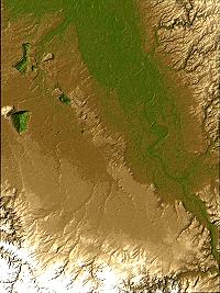
colored digital image of the
entire model area
Above top: Section of the lignite
open cast mining