house of nature, state forestry office bonn
| terrain model | |
| data acquisition | |
| multimedia-software | |
| touching allowed ! | |
By utilising the comprehensive digital map stocks from the States own Geographic Information System (GIS) of North Rhine-Westphalia, more than 120 theme maps could be created, from which a selection are projectable onto the relief model with very high precision.
Information that was not available in this geo-referenced form, were digitised individually and optimised for projection.

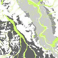
Map section of the Rhine river terraces
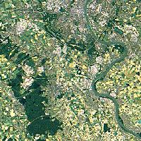
Satellite image of the Ville/Cologne region
Above top: Section of the geological map