bavarian forest national park, frauenau
| terrain model | |
| software | |
It is of special interest for the national park to incorporate and depict the areas of high nature conservation in a polymorphic visitor attraction. The visitor should be activated in getting to know the exceptional landscape features of the park more closely, and to understand them, but also accept that there are closed areas to the public in which very sensitive biotopes should remain conserved or revitalised. The Interactive Terrain Model offers a variety of visualisation opportunities, which can be used by the individual visitor, but which are also outstandingly suitable for guided tours.
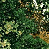
Above and right: The seamless overlay
of an interpretation (map)
and a satellite image of the region
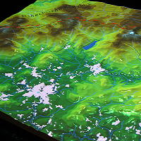
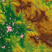
Above top: Projection of infrastructural information
and altitude layers