viking settlement haithabu, schleswig
| Terrain model | |
| Designed exhibit | |
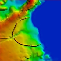
During processing of the digital elevation model was the "deconstruction" of today's surface features in favor of the presumed historical holdings in the foreground. These interventions in the digital data were more clearly necessary, because a very high-resolution terrain models with 1 m grid size was available, that displays even smaller morphological features such as field ditches, hedges, roads and houses which are exclusively of modern nature. These had to be removed.
Also the distinct surrounding earth wall and the west-facing other wall do not correspond to the suspected geometry of 800 AD. Both, however, were mechanically removed and replaced by the correctly proportioned elements of that time.
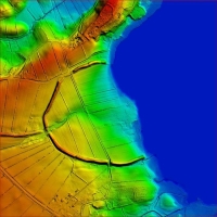
above: original 1m digital elevation model
"optimized" modell below
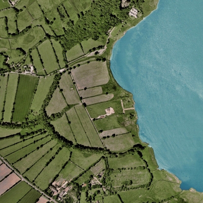
left: areal photograph of the settlement.
Very well displayed the surrounding
half circle earth wall