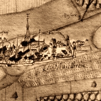
cistercian monastery maulbronn
| Terrain model | |
| Map processing | |
| Software | |
In addition to the state's own GIS data sets to represent the current infrastructure was the evaluation and integration of historical maps in the foreground. These were geographical recordings dating back to the 15th century. This enabled geographic features to be reviewed, especially regarding the conduct of the monk's delicate ditch and canal system and the arrangement of the many artificial lakes.
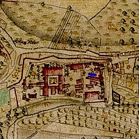
With a rather modern cartographic record of the monastery dating from 1761, the so-called Spaeth map, even the approximate reformating into a modern geo-projection system was successful, so that these old maps became suitable for a fitting projection onto the terrain model.
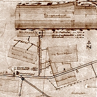
Detail of the drainage system
of the monastery, 19th century
above: Detail of Spaeth map, 1761
below: Detail of Kiesersche Forstkarte, 1684