eifel
national park
![]()
| Concept Visitor Centers | |
| Terrain Models | |
| Software | |
| Visitor Centers - 4 Locations | |
The often problematic harmonization of border-crossing digital elevation data within the European arena could have been solved with the support of the Department of Geography of the Aachen Technical University (RWTH). The total area of interest of the terrain model covers in its western parts national territory of Belgium. Through this cooperation a consistent data set could be produced such that German and Belgian data fit seamlessly. Since several terrain models had to be manufactured for the various visitor centers, cost-intensive repeated CNC-rounds had to be excluded. Instead a mirror image of the model had been milled as a base. The mold of which was afterward utitilized for further glass-fiber reinforced plastic copies.
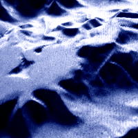
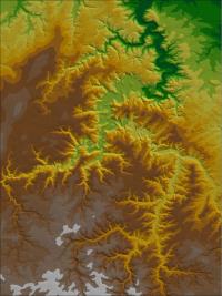
View of model (normal), digital 3D-relief
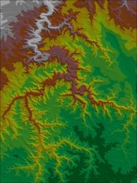
View of mirrored model, digital 3D-relief
Top: Detail, flat surface
of lake Rur after milling